The Railroad Bridges of Coon Rapids Boulevard 2011
2011 saw a serious increased effort in trying to write the remaining four Coon Rapids issues of Wasted Quarter. In September, I came back to Minnesota for a vacation, with a list of subjects that I needed to photograph. Number one feature of this town would have to be the dam. I have enough pictures of that. If we're ruling out all of the historic self-storage facilities, I'd have to the say the second most recognizable landmark of Coon Rapids, would be the Clay Hole.
(Sounds classy doesn't it?)
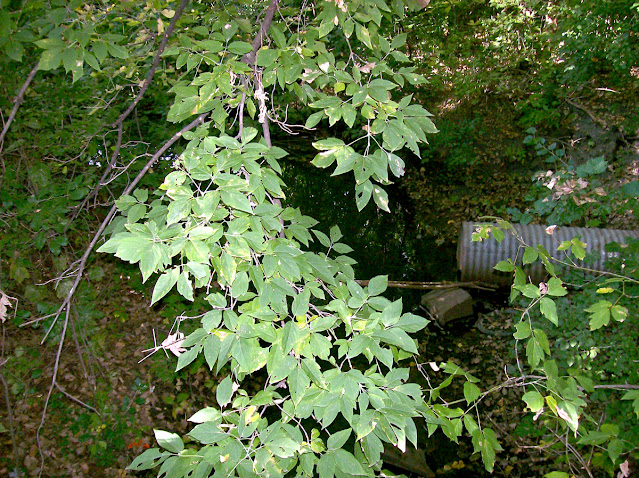
This isn't the Clay Hole, but it leads to the Clay Hole...
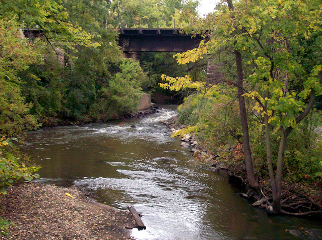
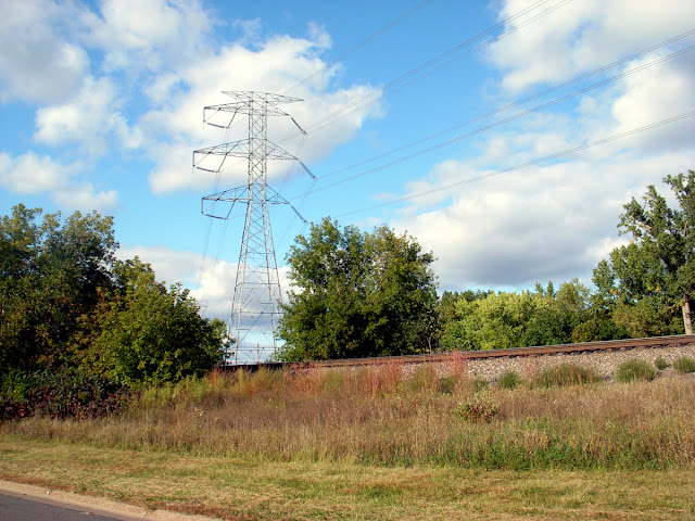
Coon Creek flows in from the north, under the railroad tracks, past the Clay Hole, under Coon Rapids Blvd. and off on it's way to empty out into the Mississippi River. Just south of the dam, and a few raccoons, which (roughly) makes the logic behind the town name...
In August of 2011, Laura created a Coon Rapids nostalgia page on facebook. I was one of the first five members, and made an administrator shortly after. Which I thought was an interesting choice because I'm not a people person. Within the first month, her group had over 1000 members. Today, we're less than a hundred away from 10,000. In the early days of the group, it was a flood of great information. That slowed considerably over the years as people left, and the action became more bland than memories. After all, how many times can you talk about the Clay Hole? (Besides me... Now...) Back in the first months of the group, I was adding bits and pieces of conversations to my notes, on a daily basis. Obviously the Clay Hole needed to photographed for those issues of Wasted Quarter, but of greater interest to me was the railroad bridges in the immediate area.
September 21, 2011
I parked the car I rented for the drive to Minnesota, in the lot at Al Flynn Park. Near the break in the trees that forms a narrow path, leading up to the railroad tracks. Because I like these bridges more than the stinky, swampy Clay Hole, I chose to take pictures up here first. This view is facing southeast, with the bridges over Coon Creek at the center.
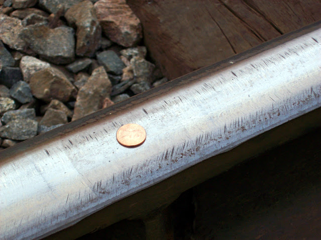
Looking down by the tracks, I found a penny! Certainly someone had intended to leave it on the tracks, for a passing train to flatten. Guessing the vibration of an approaching train knocked the penny off the rail, before the train got too close. So it would be the right thing to do to put it back.
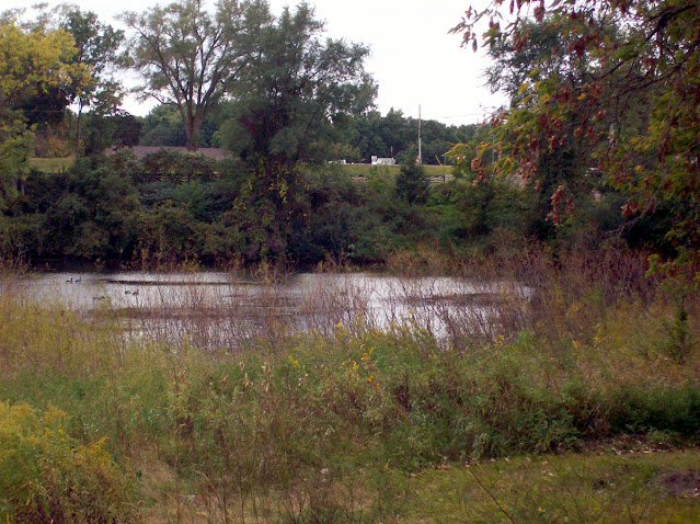
While I wait for that to happen, I guess I'll go look at the Clay Hole. I can always come back to the bridges for a little graffiti check afterwards. This would be the photo I took from the bike path bridge, once I turned around after taking the railroad bridge picture that lead off this story.
The southernmost lagoon of the Clay Hole, with Coon Rapids Blvd. behind it.
Beyond the Clay Hole, and across Coon Rapids Blvd., used to be the home of the Coon Rapids Shopping Center. Which was once the closest thing Coon Rapids ever had to it's own downtown. Many in town believe the city intentionally sandbagged this area, in favor of Riverdale, in the mid 1990's. The entire shopping center was demolished in July of 2004, with intentions of a residential development taking it's place. Due to reasons, construction on those houses did not begin until late 2019.
I'll discuss the former Coon Rapids Shopping Center some more at some indeterminate point in the future.
The Coon Rapids Historical Commission placed a commemorative plaque in front of the Clay Hole. Less bird poop and more punctuation would really help here. But it summarizes the Clay Hole satisfactorily, so I don't have to spend hours researching, to come up with roughly the same information. Bricks were made from the clay found here. They were cooked in an oven a couple of miles east of here. People bought them and stuff was built with them. Then it was demolished in favor of something new and ugly. I can only hope I was there for pictures...
The Clay Hole swimming beach was permanently shut down in the early 1990's. It had been closed intermittently for several stretches before that, while the city tried to make the water less disgusting. They didn't succeed... I remember riding in my parents car, passing the Clay Hole and seeing people swimming. I never once swam in the Clay Hole waters, but there are plenty of stories about what those who did, encountered in those waters.
Because anyone who has spent time living in the CR, can tell you that down at the bottom of the Clay Hole, there are 17 train cars, a crane, dinosaurs, a second Willie’s franchise, the secret of life, Jimmy Hoffa and the exit from hell. I’d say it was the entrance to hell, but it smells a whole lot more like an exit.
The beach would have been in the center of this picture. Where all the tall grass and weeds are now.
Even without the sign, I can't imagine anyone wanting to swim in that yuck...
But for now, I'm going to walk back up the bike path...
And start this whole story over again at the railroad bridges!
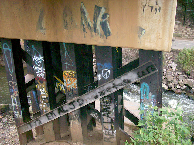
Easing down the steep rocky bank, to reach the underside of the bridge, I was disappointed in the lack of compelling graffiti. The only thing noteworthy here is the word "Reclamed". Only fixed with a last minute i, wedged in. Not sure what about these support beams were reclaimed (or reclamed), but there you go...
Look out! TPK has claimed this bridge foundation. And he apparently did so at 4:20. Well that's cute... Almost as cute as his tough guy tagging at the opposite side, where he warns you not to fuck with him, but didn't plan out how much space those letters would take to express those threats. Hard to be tough when you run out of room to boast! We know that TPK absolute can't stand for The Perfect Kerning.
Ha! A typesetting joke!
Bet you didn't think you'd get that here!
A bunch of nothing tagging. But at least it's colorful.
And sexy...
More colorful graffiti under the bridges.
And we found the Juggalo!
No graffiti, just structure. Which had to be significantly altered to show detail.
The second bridge appears to be quite a bit newer than the one next to it.
Nothing spray painted here that stands out to me...
Unlike this terrible swastika and hilariously awful pot leaf. Was this you TPK? You should be ashamed of yourself! And your green spray paint cans should be taken away. Dert, Flar and 2 Canz$ are just gonna laugh at you!
(As a side note, Saxon Motors in Elk River was recently demolished. The generous souls on the demolition crew did me a solid and left the entire property WIDE OPEN! There was so much great new material from Elk River's own Beach Boyz, found inside that dark and crumbling cement structure! I simply have to update my 2019 story in the near future!)
Back in early 2003, Wasted Quarter Issue #54 ("I Don't Care What You Do, As Long As It Doesn't Interfere With Basement.") was printed. The feature story of that issue was the Minnesota Journal 5. Detailing the ten days of September/October 2002, spent in Minnesota. Wasted Enterprises Staff Cartoonist, Tracy, drew a series of cartoons to illustrate my journal formatted story.
One of her cartoons was inspired by our walking around underneath these same railroad bridges:
Imagine my shock when I walked around under the bridge in 2011 and...
IT'S STILL THERE!!!
******
September 24, 2011
Before I drove back to Minnesota, my friend Eric said he wanted to meet up while I was in town. We decided to drive around and continue my photo taking mission, on a Sunday afternoon. He would bring his camera to provide a second perspective. At the end of the day, I copied all the pictures he took off his memory card. Some of the pictures I'm using in this story may have been taken by him. I apologize for not knowing which ones.
I also had my Dictaphone set up to record in the car, so we could discuss Crapids stories as we drove around town. The material covered there would be almost as valuable for my notes, as the pictures we'd take. After leaving the folks house that (Sunday) morning, I met Eric in the Northdale Shopping Center parking lot, which we photographed before setting out on our mission.
Nearly ten years have passed since that day. Looking back at the pictures we took shows just how much this town has changed in the last decade.
We were going to meet at Club Billiards, but that place closed years ago...
Hanson Drug is also no longer at the Northdale Shopping Center. Hanson Drug is no longer anywhere...
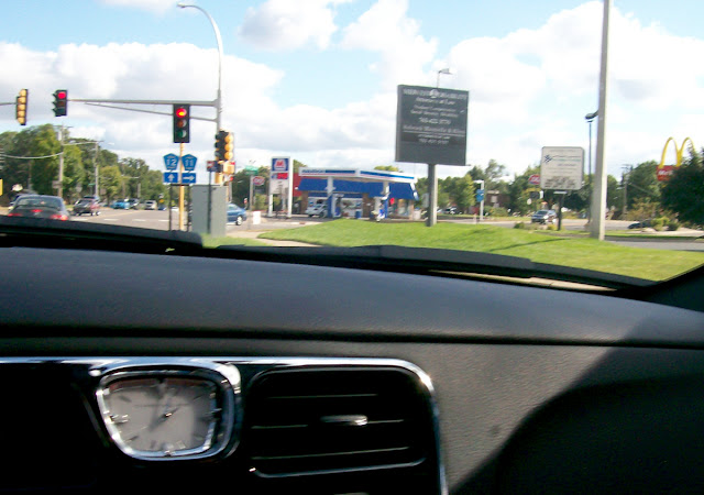
I tried to take a picture of the Marathon gas station at Foley and Northdale, while waiting for the light. My camera didn't take the picture in time, so it came out blurry with too much of my (rental) car and too little of the actual gas station. Marathon was closed and demolished in 2016, to make way for expansion of Foley Blvd. While I didn't get pictures of the demolition, I was in town to take some great photos of the station looking all sorts of abandoned.
That will be featured here some day.
And I have to mention that stupid clock at the top of the center console. As soon as I picked it up from Hertz, I had to laugh. It looked so out of place in a 2010 car. I did appreciate the CD player, since the cassette deck in the Blueberry Honksicle died in 2008 (if I remember correctly). And yes, I did smoke in the rental car. Cleaned it better than any car I've ever owned after returning it. They never said a word. Sometimes you gotta break the rules...
Also at the Foley/Northdale intersection, you could find the closed up Top Shop. Top Shop is the last convenience store to operate in this building. It used to be a Tom Thumb store, before that chain ceased operations. In recent years, Herr's Oriental Market leased the store for a few months, but it is currently an MMA gym. Or something like that. All I know is that I'm not going to buy any comic books there...
I covered Oak Park Plaza in an epic story here a few years ago. Many of the pictures we took this day were used in that story. I had no idea at the time, when Laura and I moved back to Crapids, just how important Oak Park Plaza would become for a stretch of time.
Snapped a decent picture of Go For It Gas, while waiting for the light at University and 105th. This station would close in early 2016, and provide me with some excellent photos that August. (A guy in a big pick up truck pulled up and asked what I was doing, while I was taking those pictures. I told him that I was going to build a Dunkin Donuts on this land. He was excited by my made-up news. More of that story will also appear here someday...) When I came back to Crapids in late 2017, Go For It Gas had been demolished. A Tumble Fresh Laundry lives here now.
Regret not pulling over for better photos of Yes Gas. This used to be a Super America station about 30 years ago, before becoming whatever dirtball name it was that month. This station was obviously too tiny to survive in today's retail petroleum climate. I do not know when it closed, I do not know when the building was demolished. Just that I liked it and wished I had more and better pictures.
Yeah, this picture sucks...
Blaine K Mart was still open on September 24, 2011. It even had a few customers that day. It was still open in 2012, but when I came back to Minnesota in 2015, it was closed. This is another story I'll probably write about here at some point.
But I will definitely write one for the former Blaine Rainbow Foods! Rainbow closed in the Spring of 2014, when the chain ended operations. (I blame Cub.) During that same September 2015 visit (where I found a closed Blaine K Mart), I discovered that even though Rainbow Foods was no longer selling $45 in empty calories, there was still an open bank inside! No one told Guaranty Bank the store surrounding them was closed, because there they were as open as you could be! And that looked really strange.
I took a few pictures of that weird visual, before leaving. There was a security guard sitting there, and I wasn't a customer of the bank. So, in and out quick, get on with your day. A few months later, Laura was back in Minnesota, while I stayed back in Colorado. She went to the closed Rainbow with the open Guaranty, and lied to the security guard. She told the guy that she used to work at Rainbow, and wanted to see the place. He didn't care and she wandered all over the building, getting a bunch of great photos all over the Rainbow. Some of them were blurry, but this was going above and beyond the call of duty! That story will find it's way here in the future.
Guaranty was gone in 2016, and the former Rainbow has sat sad and vacant ever since.
Since I'm in the area, what's going on at the (former) Shinders?
In September 2011, it was running as the Mega Media X Change. What used to be the CD Exchange down the shopping center, moved into Shinders larger old space, a few years back. Then they went out of business soon after. There was another store here for a while, but they didn't last either. As far as I know, the space is vacant again.
For all of it's shortcomings, I really wish it was still Shinders...
Of course it would need to be the early 1990's again in order for Shinders to still be decent. I'll even let that slide up until that meth-head took over the franchise and promptly ruined it...
Let's continue our drive around -and avoiding of- Northtown Mall and set out for the most important non-Crapids landmark I needed to photograph today.
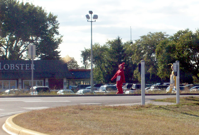
Unfortunately, I wasn't prepared to see some people dressed up as Teletubbies, walking around the University Avenue median, in front of Red Lobster. I tried to get a picture of them before the light changed, but this was the best I got. And no Tinky-Winky...
Despite not being part of Crapids, Columbia Arena was one of the most important photo subjects of this trip. The Hockey arena(s) closed for good in 2007, and had been sitting empty and deteriorating for four plus years at this point. Columbia Arena would finally be demolished in the fall of 2015, to make room for Fridley's new city hall, police and fire departments. I was in town during the demolition, but other than once driving by in the middle of the night to see dark silhouettes of destruction, I missed it.
This is still yet another big story I plan on covering here eventually...
After walking around the hockey arena for a decent chunk of time, Eric and I took a food break at the Fridley Zantigo. I didn't take a picture of that, so we'll substitute a Zantigo photo from November, 2017. I'm usually alone when I stop here, get a couple of tacos and a few Chilitos, and jot some thoughts down in my notepad while eating. Covid took that away from me, since Zantigo has been drive through only for well over a year. Chilitos aren't as good to-go, without a side of notepad scribblin's.
And they wouldn't accept my coupon either! Something about it expiring in February, 1982... Not to mention the Fridley location having been part of a large apartment complex for well over a decade.
Oh well, let's get back to Crapids. Up next was the planned fantastic voyage west on Coon Rapids Boulevard. All of the decay was slowly getting cleared out, but it was still looking fairly rough. Not as bad as 10 years earlier, when I really needed to start this project...
Too bad the Coon Rapids Fuddruckers had recently closed, or that could have been a dinner option. At least the sign was still standing for a photo!
I'm going to jump ahead at this point, and tell this story out of order. So we'll breeze on past the major chapter and come back to it after we finish driving west.
For some reason, I pulled into the small parking lot to take a picture of The Pressroom. Eric took a picture of me taking that picture. I wonder who works here? Behind the Pressroom, you can see part of the Car Wash Formerly Known as Buff 'n Shine. Should have gotten out and walked over to it. The car wash and former Anoka County Rent-All were demolished in 1995, in favor of the worst SuperSpeedwayAmerica on the planet.
This place was still here in September, 2011... No joke! Go read about it here...
I still want to punch that caricature on the sign, in the face.
There were more buildings of note as we went on our way. The BP Gas station at Crooked Lake Blvd was closed again this month. It would close and reopen several times over the next few years. It's open today, you can tell be all the painted on ads for CBD. I spent way too many years in Colorado to buy into that crap here, but it seems to make these indy gas stations a ton of money. So, good on ya!
We should have stopped at the Family Center Mall, but didn't. Dairy Queen was still open and deemed not worthy of a photo that day. And Cheap Skate didn't seem to have any human trafficking going on this afternoon.
The WCCO radio tower building still had the large orange call letters attached to the roof. As well as the more subtle WCCO letters on the brick wall. Both of those have been removed at some point in the last five years. I'm not sure why. WCCO radio is still going strong, but this tall antenna has gone incognito since around 2017.
After the WCCO building, we had to make a quick right turn into the Round Lake Shoppes parking lot.
The Round Lake Shoppes were built in the mid 1980's, as business on the boulevard was booming. Ten years later, businesses were leaving the boulevard for the endless parking lots of Riverdale. This shift killed the boulevard, leaving decaying properties and empty storefronts in once busy retail zones. While a lot of the boulevard has since been cleaned out, there are still plenty of open spaces with no tenants to fill them.
Behind the Shoppes, is the WCCO Radio Tower. Which I'd probably rank as the #3 Coon Rapids landmark. Without it, residents wouldn't be able to pick up "The Good Neighbor" during their phone calls. Although, that's probably less of a problem with so few people using land lines these days.
After failing as a gas station, Yes Gas moved to the Round Lake Shoppes and decided to become a restaurant instead. That's most likely not accurate. I don't know anything about Yes And Food, beyond the name not making any sense. And that it's no longer open.
Neither was Rally Gas & Grocery... When the Round Lake Shoppes opened, it was anchored on the west end by a Food and Fuel gas station. Years later, it became Rally. And at some point over ten years ago, it stopped being a gas station. Today the space is part of Premier Disability Services. All hints of any previous gas station are gone, other that some mismatching pavement in the parking lot, where the pumps and canopy used to stand. Rally Gas & Grocery will definitely have it's own dedicated story here, one of these days.
Lindees Saloon no longer operates here, but it's still the same type of restaurant. Now it's the Boulevard Bar and Grill. I've never eaten there, but it gets favorable reviews online.
Too bad we didn't take any pictures of Nature's Nursery (formerly Pederson Floral) while driving this section of Coon Rapids Blvd. Maybe it was still open in 2011? I don't know. But since we didn't take a picture of it then, I can't show a picture of it from a different day in this story. Sorry, I don't make the rules here...
Which is a shame because this abandoned and crumbling structure is currently my favorite one inside Coon Rapids city limits. However, it's starting to outwear it's welcome in my mind. It's peak as an awesome example of urban decay came shortly after the property was sold to the neighboring U-Haul self storage next door. Which is fine, I get their idea for expansion of their facilities. Demolishing the outdated flower shop in favor of more self storage makes sense.
But are you ever going to do it?
The adjacent greenhouse was taken down over a year ago (or maybe it fell over?), but the building is still there. More windows are boarded up by the month, and the only storage U-Haul is getting out of the property is in the form of overflow parking. I drive by Nature's Nursery twice a day, going to and from my job, and it just gets sadder and sadder. At this point just get it over with and scrape the land and build your big stupid multi-story glass and cement stuff container. Put Pederson out of it's misery!
Just follow the example of McKay Collision & Service! The car repair shop on the corner of Coon Rapids Blvd and Round Lake, had to wave the white flag in order to make room for a kidney repair shop. And the neighborhood is better for it. I mentioned McKay first because Eric and I had to cut through their parking lot in order to access...
Frank's Nursery and Crafts! Their parking lot was blocked off, so we left the rental car behind some trees at McKay. Frank's deserved a dedicated walk around for pictures. Those will be covered later. I'm glad I took them in 2011, both Frank's and McKay were demolished the next year, with the Frank's property replaced by Autumn Glen Senior Living. A large apartment building that took more than just Frank's to provide the space for it.
After our self guided tour of the abandoned Frank's, we crossed the border into Anoka. I'd heard that Frisky's closed, so I needed a photo of that. Unfortunately, the sun was running interference, making this shot look all sorts of terrible.
One of the last remaining PDQ gas stations needed to have it's photo taken. I don't know when the changeover happened, but the next time I was through this part of town, PDQ was gone. The gas station is still open, and it still has the red color scheme, but now it's just Anoka Gas. That's lame.
And it's enough Anoka for now...
Let's go back in time several hours and several miles east to...
Coon Rapids Blvd Extension!
It's just like Coon Rapids Blvd. Only older and a lot narrower!
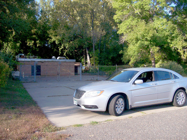
I turned onto Vale Street, which runs parallel to the railroad tracks and leads to another self-storage place, to park the rental car. Coon Rapids Blvd Extension is only two lanes, leaving us nowhere to park. So in order to take the pictures I wanted, I had to find someplace to stash the car. A desolate Vale St. worked just fine!
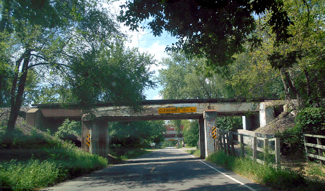
These three railroad bridges were why we stopped. The first two rails run from Minneapolis/St. Paul, northwest to Fargo, North Dakota (and probably beyond). The third bridge, seen in the distance, turns to go north, up to Duluth.
Vines have overtaken the barrier separating the sidewalk from the road.
They look pretty beat up today, but have been standing here for almost 100 years.
The two southernmost bridges are not uniform in construction, and seem to be pieced together to make them stable.
A pile of railroad spikes were laying on the side of the road that didn't have a sidewalk. One of these may or may not have happened to fall into my rental car (by accident), and ended up landing on the fireplace mantle of my old apartment in Englewood, CO. I cannot verify whether or not that actually happened...
Someone was practicing their Minnesota Area Codes with spray paint. And I've never seen F.T.W. with antlers before. So I don't know what that means.
Guess it's a scam?
I knew there would be plenty of graffiti on these bridges, and they did not disappoint. Who knew that Coon Rapids had it's very own free art gallery?
And I've long been convinced that people that spray paint penises on things has never actually seen a penis...
Wanna bet this guy realized he forgot the "e" only after tagging the dollar sign and the h?
He also forgot to paint this rubber armed naked lady some feet. She's covering up some orange "Meow was here." How does a cat hold a can of spray paint without opposable thumbs?
Meow was there too... Marking territory in orange, then once again in purple for good measure...
For years I have bugged Laura about letting me change the header graphic for the facebook group, from a picture of the dam, to this picture. She always shoots me down. Guess she doesn't like Lil' Smokey...
There's some more art in this mural that deserves a closer look...
See what I mean about graffiti penises?
Hmmm... The purple hyroglyphics don't seem to agree with the statement. The first image looks like the stick man is stabbing the other stick man in the face, well above his mouth. The second image implies that his stick penis has a gun, that shot the other stick man in the waist. Causing his neck to grow longer than his torso, then break in half. However, I like how the artist attempted to conceal Brandon Cooper's identity by scribbling out his name (poorly), then switching it to just "B".
It's a bold statement, and this whole piece speaks volumes about the struggles of man in today's ever changing and violent world. By giving the first set of stick men faces, but leaving the faces off the second set of stick men, the artist is comparing the struggles we all face in our daily lives. It's an analogy about having a face (and your whole identity) out in the open, vulnerable to large sword shaped stick penises. While the second removes all hints of identity, in the face of the gun wielding stick penis.
This is truly some impressive work. Too bad the artist chose to not sign his work, leaving even more questions than answers as to his (or her) motivation.
Bravo, I say!
I peed here.
Before walking back to the third railroad bridge, I moved the rental car to the pump station before the bridges.
And walked down to the northbound tracks.
This bridge also dates back to 1926.
Lolli Baby approves...
Grow Those Flavorful Oranges?
Gonad Throwers Fight Oppression?
Go Towards Fridley Or-else?
Grandma Tastes Fairly Old?
Gas Tank Fire Oh-boy?
Giraffe's That Fornicate Orangutans?
Glossy Turds From Oprah?
I'm beginning to think the Coon Rapids Blvd. Extension Railroad Bridges just don't like people named Brandon. And again with the terrible genital art... It looks like he "suks" baggy sweatpants.
Just north of the third bridge, Coon Rapids Blvd Extension curves to the east. This was the original Highway 10, that cut across Coon Rapids, before the much larger and more expresswayier Highway 10 was built about a mile north of here.
While it's hard to imagine a large volume of traffic taking this road on a daily basis, the amount of vehicle-caused damage to the underside of all three of these bridges tells a different story.
On the southern half of this curve sits a cluster of townhomes. 35 years ago, there was something much cooler. Coon Rapids once had it's very own Drive-In theater. The screen would have been roughly beyond this clearing in the trees.
Better illustrated by this aerial photo, dated November 12, 1971. The railroad tracks I've been talking about are on the left side of the picture, however, the bridges are out of frame in the upper left corner. The Coon Rapids Drive-In Theater closed permanently in 1985. It sat vacant until 1987, when all the townhomes started popping up in the parking lot.
I didn't know her at the time, but in 1986, Laura's dad went to the closed up Drive-In Theater, and snapped some pictures. Laura found these and sent them to me for use in the Wasted Quarter Coon Rapids issues. I was overjoyed to just see a photo of the decaying Drive In Theater sign, but she also had photos of...
The back of the theater lot, complete with some audio speaker poles, still sticking out from the ground...
And a nice perspective photo of the theater screen and projection house. Would have loved to seen the inside of the projection house, but I'm not going to be picky. I remember going to movies here with the family when I was too young to stay awake through them. Of course there were the glimpses at the movies you could see while crossing the Coon Rapids Blvd railroad bridge. I was sad when the place closed, but I was only 10, so I didn't have a whole lot of perspective. Since all signs of the Coon Rapids Drive-In Theater were gone by 1987, I didn't think I'd ever see it again.
Funny to think Laura's dad and I would be on the same page as far as wanting to take pictures of abandoned things! I'm so glad he did!
Let's leave 1986 and jump ahead by 30 years, to August 2016. So we can get to the last part of my 2011 pictures. Make sense? Well it doesn't have to...
The north bridge (I'm driving south in this picture) is looking even more crumbley than it did in 2011.
As I approached the second set of bridges (Fargo-bound), I was irrationally concerned that one of those heavy shipping containers was going to fall off the train, and onto my car. Obviously that didn't happen, but it did go through my mind. Underneath these bridges, there were likely several coats of paint covering up the graffiti from 2011. Nothing I took pictures of then was visible now. Maybe it was, I didn't pull over to look...
Coon Rapids Extension was the original road to access "Downtown" Coon Rapids. As traffic levels increased, a new road better suited for the increase in traffic was built in the early 1950's (I think, may have the date wrong there). The new road would bank up and then go over the railroad tracks. Looking to the east, one could take East River Road, which would follow the Mississippi and take you into Minneapolis. Taking the left fork will bring you to Blaine.
And no one wants to go to Blaine...
But the old Highway 10 bridge over Coon Creek still stands. Closed to traffic when the new overpass was built, the old bridge was decommissioned for traffic, and becoming a part of the walking and biking trails. 30 years ago, it wasn't painted khaki, and instead was coated with interesting graffiti. I always loved reading the nonsense spray painted on it, when the parents would drive by and I was in the passenger seat.
The surface of the bridge has this logo stuck to the pavement.
Approaching the bridge from the path. Hard to believe the volume of cars and trucks that would take this route. There is even a couple of benches for tired walkers and bikers to sit on. 75 years ago, they'd be getting run over for sitting there...
But in 2011, it was a nicely landscaped and clean monument to the past, with the new Highway 10 running somewhat parallel.
By 2016, the city must have gotten tired of doing that landscaping...
I didn't know it at the time, but Eric took a picture of me taking pictures of the old highway 10 bridge, from the island in the road, where Coon Rapids Blvd. Extension merges back into Coon Rapids Blvd. Access to Coon Rapids Blvd. Extension, was limited in 2019, when road construction eliminated all turns into the extension, from the eastbound lanes. And none of this is called Highway 10 anymore.
******
This was one of the greatest days as far as gathering material for that long-planned Coon Rapids themed set of Wasted Quarter issues. But it wasn't long after returning to Colorado that I put the project on hold (again). Work needed to begin on the grand 20th anniversary issue of Wasted Quarter, which had to be printed in October, 2013. It was. Then I moved onto writing Abandoned Englewood, and "A Big Steaming Pile of Crapids" would never be completed.
Well, you'll get pieces of it here.
That'll have to be good enough...
Oh, one more souvenir from today:
Busted Magazine
All this trash for only a dollar!
Thanks Eric!


















Comments
Post a Comment